How to Leave a Comment on Our Blog

HOW TO LEAVE A COMMENT ON THIS BLOG
1. Scroll to the end of the post.
2. Click on the phrase "0 comments" or, if there are comments it will indicate how many, for example, "8 comments." Clicking on this will open the comment option for you.
3. Type in your note.
4. Choose your Profile. If you don't understand the choices under Profile then choose Anonymous but PLEASE type your name and location at the bottom of your comment so I know who you are!
Showing posts with label Birmingham. Show all posts

Wednesday, October 28, 2015

Ahhhhhtumn Cruising! It's the Good Life


 "O suns and skies and flowers of June, Count all your boasts together, Love loveth best of all the year, October's bright blue weather." ~Helen Hunt Jackson, American poet, writer and activist, 1830-1885 

     We woke Monday to a brilliant blue sky and sunshine dappling the boat ceiling with the reflections of rippled water. Time to move! After breakfast we set off, heading southward again back towards the Lapworth Flight. I have another Physiotherapy appointment in Warwick, and I have been told I am being referred to an orthopedic surgeon for a consultation on my damaged left knee. I've registered as a permanent patient in Warwick now, so back down we go.
     We are leaving Dickens Heath, a lovely, safe spot to stop when coming out of Birmingham (Brum). It is named after farmer Thomas Dyckens who lived in the area in the 1500's. Only eleven miles for the outskirts of Brum and three miles from the large town of Solihull, a Manorial Survery of 1632 indicates Dickens Heath was ten acres of mostly common land, but it once was a part of the ancient Forest of Arden.
     A 1901 census shows that five families lived in the hamlet--all engaged in agricultural work to the surrounding farmers with the exception of the blacksmith. The fields had ancient winsome names: Hither Side Eight Acres, Round Leasow, Six Acre Piece, Maypole Piece, Three Cornered Close and Wren's Nest Close. Some of the modern roads still bear these titles. Up until 1997 nothing had changed in the hamlet. A time traveler from the 1500's could have been plucked up and set down on Round Leasow Lane and instantly recognized where he or she was standing.
994 The Council approved a detailed Master Plan. The Master Plan was to be implemented by the consortium of developers which included Berkeley Homes, Bryant Homes, Redrow Homes, Trencherwood Homes and David Wilson Homes. - See more at: http://dickensheathpc.org.uk/about-dickens-heath/#sthash.oxvYJnru.dpuf
     In 1989 a concept for a new village was created to accommodate 8000 new homes in the borough. In 1994 the village council approved a master plan submitted by a consortium of five builders and in 1996 the plan was approved following legal agreements to secure the provision of roads, public footpaths, community facilities and open space which included parkland, the village green, canal walkways, and the nearby Dickens Heath Nature Reserve. From the start the Solihull Council established that Dickens Heath should possess the features of a traditional village instead of merely plunking down a vast modern housing estate in the middle of the hamlet, isolated from everything else around it.
       As boaters we found Dickens Heath a lovely quiet spot to moor on the upper Stratford-on-Avon canal just after bridge 14 (or before it depending on which way one is traveling), adjacent to the nature reserve. A walk into the village over the modern footbridge brings one to a large set of flats with a cascading water feature. Further on in the village proper there is a Tesco Express, a chemist (drug store), a library, and bus service to the nearby towns of Solihull and Shirley. It served our needs for a five days but it was time to cruise.
Cruising past the canal side flats of Dickens Heath.
This water feature is the central piece of this mixed use development of flats, a preschool, and other commercial endeavors.
This is the base of the footbridge over the canal that leads into the village of Dickens Heath.
Up on the top level after coming off the footbridge, one can see the water steps better. Walk forward between the main building and you will come out to the main street which leads to the grocery store, hairdressers, men's barber shop, chemist, library, charity shop and other businesses. The local pub named the Poison Chalice has very poor reviews and we wouldn't recommend it. The Italian restaurant, Giovanni's, has an excellent reputation.
Looking back down at the canal from the top of the piazza. The footbridge is just out of sight on the left and NB Valerie is moored about 800 feet down the towpath off to the right. Dickens Heath Nature Reserve is directly across the way. 
NB Valerie moored up at Dickens Heath. The foot bridge over the canal is behind us about 25 feet.  Leaf litter covers the canal and waits to snare the props of passing boats.
1996 The original outline planning application for the new village was approved following the completion of a legal agreement to secure the provision of roads, footpaths, community facilities and open space, including the parkland, the village green, canal walkways and the nature reserve. - See more at: http://dickensheathpc.org.uk/about-dickens-heath/#sthash.oxvYJnru.dpuf


  • 1994 The Council approved a detailed Master Plan. The Master Plan was to be implemented by the consortium of developers which included Berkeley Homes, Bryant Homes, Redrow Homes, Trencherwood Homes and David Wilson Homes.
  • 1996 The original outline planning application for the new village was approved following the completion of a legal agreement to secure the provision of roads, footpaths, community facilities and open space, including the parkland, the village green, canal walkways and the nature reserve.
  • 1997 Building of the new village began towards the end of the year
  • - See more at: http://dickensheathpc.org.uk/about-dickens-heath/#sthash.oxvYJnru.dpuf     Les and I both love being on the move any time of the year but autumn and winter are our favorite times. The canals are nearly empty of boats, the weather is crisp and refreshing, and this season has its own charms. The air is scented with the tang of leaf fall, ripe berries, and the slow death of summer as the wheel of the year turns onward toward the cold, dark winter season with its own austere pleasures.
         As we travel along, the leaves are a multicolored tapestry of shadow and light. Tossed by a gentle wind they fall, spinning to the canal surface where leaves of varying sizes and color float in large rafts and tangle themselves about our prop. This spawns one of the overwhelming canal sounds every Fall: boats glide by and suddenly the engine is revved in reverse as the person steering attempts to clear a mat of fallen leaves from their prop; the boats set onward again, cruising quietly along.
         Our plan for the day is to cruise to Hockley Heath and stop in at Wedges Bakery and Deli to top up our fruit and veg, then return to the next bridge on to score more of the Oak limbs from the tree someone had coppiced earlier in summer. We picked up a good amount on the way up to Birmingham when there was still loads of thick, heavy Oak limbs laying around after we took our share.
         While I walked into the Hockley Heath for supplies, Les stayed with the boat and sharpened the chainsaw. As I walked along the lane into the village, I passed four houses backed onto the canal. There was an open piece of ground next to the last house and I was shocked to see that in the three weeks since we had first passed on our way up to Birmingham, all the trees--over thirty of them--had been cut down, with stumps protruding from the muddy ground, and long lengths of branches trimmed and laying helter-skelter. I planned to mention this to Les when I returned to the boat, and suggest we knock on some doors to see if we might have some of the wood. 
    I walked between the posts, and turned right on the road. Wedges Bakery is 100 yards further along. The Birmingham Railroad Engineers Society mentioned in an earlier post of Les' is on the left down the road.
         At Wedges I picked up some farm fresh potatoes, a cabbage, plums, onions, a punt of beautiful ripe strawberries--the last good ones we will get until next spring. I also decided to splash out on a loaf of fresh baked seeded brown bread, three slices of oven baked Turkey breast, a wedge of Wookie Hole cave aged Cheddar and a wedge of Apple-wood smoked Cheddar. I thought I would surprise Dear Sir with a Ploughman's lunch.
         Back at the boat Les was chatting to a friendly young bloke with long dreads, smiling brown eyes, dressed in typical gear of old, worn but mended jeans, layers of shirts and a tattered cardigan--a fellow live aboard boater dressed just like us! His arms hugged a bag full of Wedges goodies. He and his missus live on the boat we had passed back around the last bend. The men were talking wood of course, and the young man told Les about the recently cleared lot. He mentioned he had spoken to someone at the weekend who was cutting down the trees, and that bloke said it would be fine to come 'round with a wheel barrow and take as much wood as he liked. He encouraged us to help ourselves saying there was plenty of wood for everyone. Of course I could hear Mo of NB Balmaha in my head, who once wrote on his blog, "Aren't boaters  lovely?" By and large they are indeed.
         Les helped me on board with my bags and then walked down the towpath to investigate. He didn't get far. An elderly couple in one of the houses was out gathering plums from their tree. They had a brief chat with Dear Sir, saying the land had been sold at auction and cleared of nearly every tree, with the wood free for the taking. We moved the boat along and moored up adjacent to the back of the plot, where there was a low, open spot and Les climbed over and began to hoik long lengths of wood onto the towpath. 
    There was Oak, Apple, Cherry, Laurel, Plum, Spruce, Holly, Hawthorn and it was clear to me that the plot of land had been someones much loved small orchard and garden plot.
    Dear Sir with his happy woodsman face.
    Watching Les work with wood is a thing of beauty. He revels in it and I love the security against winter's cold this wood brings with it. I look forward to stacking the cut lengths on the roof.
    We are so top heavy with wood NB Valerie handles like a round bottomed wide beam!
    Pigpen © 1954, Charles Shultz
         We took mostly Cherry wood lengths as they were large enough to provide good wood for burning but small enough for Les to carry on his own. My dodgy knee didn't allow me to help much. I did take lengths from the towpath and help stack them on the boat roof. Typically, Les barely broke a sweat and only had a bit of dirt and sawdust on the shoulder of his shirt; I was covered in mud, soaking wet, and filthy from head to toe. I looked like Pig Pen's older sister! Apparently the shorter one is, the closer one is to the mud and the more one is likely to be coated with it. That's my excuse and I'm sticking with it. 
         We cruised on to the next bridge thinking to pick up a bit more of the Oak but lo and behold there was none left. The site had been expertly cleared of wood and the smaller branches and debris had been piled off to one side. Never mind, NB Valerie is so top heavy with wood she is sluggish to move, takes longer to start, stop, and handles completely differently.
         As Les took us further onward I showered off all the mud, changed clothes and put a load of laundry on to wash. I love a near scalding hot shower. I relished the way it warmed me from the outside in, cleaning away the debris of the day. showers aboard a boat may be short--only 3 minutes by comparison with the five, eight, and ten minute showers I used to take back at Cloud House, but I relish them more. Every drop of hot water is precious and restoring.
    A lovely Autumn day cruising along in the dapples sunlight with a log loaded roof! Onward to fill up with diesel, water, dump the rubbish, replace an empty bottle of Calor Propane with a full one and Bob's your uncle!
         Smelling faintly of soap and rose oil, I climbed back up the stern, nestled in my down jacket. I was commenting with some satisfaction about the fact we had only encountered two other boats on the move all day, when we came round a bend to see two boats coming at us cruising side-by-side. Les slowed NB Val to a crawl while we waited to see what was happening. One boat dropped back though both kept approaching us, the rear boat with its bow practically up the stern of the vessel in front, driving the front boat into the tow path where it became grounded.     For some reason a Kate Hire boat out of Warwick was traveling with a rough looking boat of no visible name or license, roof rammed with doo-dads and a large flag with a red and black skull, helmed by a youngish man and woman and several children--all with dread-locked hair and knitted hats, running to and fro, hopping from one boat to the other like fleas between dogs.
    The clueless hire boater who was apparently being helped along by a family of live-aboards.
         The bloke on the back of the Kate boat appeared to be a late middle aged hire boater totally confounded about what to do with the boat at his command. It was now good and grounded. The younger bloke was moving along its gunnels working his way from the towpath side over the bow to the off side while the young woman at the helm of the rear boat decided she would back up and then plow on through between the Kate Boat and us, driving us into the mud on the off side!
         A chorus of "Sorry! Sorry!" ensued with young Dreadlocks shrugging his shoulders and instructing Les to just carry on and shove his boat out of our way with our bow! Les kept a cool head, held NB Val stock still while the young woman scraped between the two boats, then turned us in gently and came forward of them. Meanwhile the woman moved 'round to the front and promptly bottomed her vessel in the mud. The hire boater looked at us completely baffled and said, " It's just so shallow this canal--not enough water is there?" We shook our head in consternation, perplexed by the entire shebang, and finally made it past them.  
         Les let me off the boat at draw bridge 26 and I wound up the bridge while he took it through and moored up under a nearby Oak tree. I wound the bridge down and went inside to fix lunch.
         The sun was dipping low in the sky--especially as the clocks over here in the UK moved back an hour last weekend. We stopped at Swallow Cruisers to fill up with diesel, pick up a bottle of Calor propane for the kitchen range, and top up our water and coal. 
         We had the top four locks of the Lapworth Flight ahead to do and the air was decidedly cooler now that the sun was an hour away from sinking all together. We cruised on. As the sun slowly disappeared the cold began to settle in our bones. Smoke skirled from the chimney, filling our noses with the incense of dried wood. We  went down through the first four locks and I brought the boat into the side of the cutting above the next lock so we could moor up for the night. Small bats flitted around us in the gloaming and our solar powered deck lights on the roof lit up. 
         What a glorious day for cruising and so typical of this time of year when the canals are mostly empty of boaters except us continuous cruisers and a few pleasure boaters trying out the cut for a short break. Needless to say we both slept well, waking to an oatmeal sky and warmer temperatures. We were once again the only boat on the move and we started down the rest of the Lapworth Flight. 
         Since we had the locks to ourselves we took our time. Les set the lock ahead, raising the gate paddles to fill the lock and then he opened the gate for me. I cruised in, slowed the boat to a stop with its nose at the bottom gate, and while Les walked down to set the next lock, I closed the top gate behind me and wound down the gate paddles, then walked over and wound up one of the lower gate paddles to let water out and carry the boat down. We worked our way down 8 locks in an hour and three minutes--a very good time.
         We stopped for a tea break between locks 14 and 15. A hire boat came up and we knew the rest of the locks were in our favor so we carried on down four more locks where we topped up the water tank and disposed of our rubbish. Then Les locked me through the final two locks into Kingswood Junction Basin. I turned the boat, took it through the eye of the needle as I call the narrow connection between the Grand Union and the Stratford-on-Avon canals. I slowed to pick up Les and cruised past the moored up boats, turned NB Valerie at the Junction and we moored up to stay through Saturday.
         We will take the train from Lapworth to Warwick for my next Physio appointment, then walk into the village on Saturday for a Daily Mail weekend newspaper. then we will scarper off to a bit of quiet countryside with a broad, open view where Les can saw logs into rounds and chop wood into lengths and I will stack them on the roof. That's our winter wood settled!

    Sunday, October 25, 2015

    21st Century Navigating: Goodbye Nicholson's Guides, Hello Electronic Maps

    "Any sufficiently advanced technology is indistinguishable from magic." ~Arthur C. Clarke

       Most of the boaters we know use Nicholson's Guides to navigate along the 2000 miles of British waterways. To date there are seven Guides--one for each canal/river section: Grand Union, Oxford & the South East, Birmingham & the Heart of England, Four Counties & the Welsh Canals, North West & the Pennines, Nottingham, York & the North East, River Thames & the Southern Waterways, Severn, Avon & Birmingham. These Guides are printed spiral bound books with forty years of experience behind them, based on Ordinance Survey (OS) maps. Stanfords, a map sales web site, offers this description: 

         Ordnance Survey’s mapping from their Landranger series has an overprint highlighting the waterways and adding locks with their names, number and rise, also staircase locks, weirs, turning points, various facilities such as overnight moorings, water points, sewage and refuse disposal, food shops, public houses and restaurants, etc. Towpaths, which can also be used by hikers or cyclists, are clearly marked.
         The guides provide descriptions of towns and villages, contact details and where appropriate opening hours of local services, etc. Each guide also includes an introductory section with general advice, regulations and tips.
         First printed in the 1970's the Guide sold for all of 75p. Les bought his set back 2005 when he first made plans to live on a boat. Our guides are tea stained, dog eared, and full of notes about which spots are our favorite moorings, which direction to find a satellite at specific mooring places, which direction the TV antenna should be pointed, and nowadays which sites offer the best 4G wi-fi signal.
         The problem with our Guides is that they were actually printed in a date range from 2002-2006 making the data inside woefully out of date. These days the cost of a single Guide is far dearer--£16.99, and we've recently been informed that several of the newer "updates" didn't actually change any of the information inside; the only thing updated was the pictures on the covers which resulted in a fair few boaters returning their new Nicholson's Guides and asking for a refund.
    Seven Nicholson's Guides plus a Fens Waterway Guide--all out of date, expensive to replace, dog eared, and taking up precious shelf space on our narrow boat.
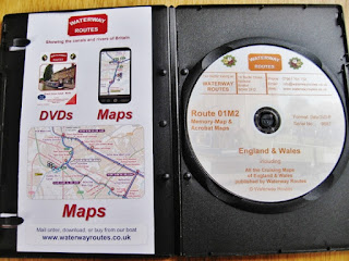
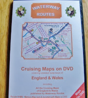
          Enter one of our favorite boaters, Paul Balmer of NB Waterway Routes. Paul has been traveling and mapping the British waterways for about a decade now. He also uses OS maps as a base for his canal maps, however any comparison to a Nicholson's Guide should stop here. Paul's maps are far more detailed in terms of where services are located and what ones are available. His maps are easy to read, and also include all the old, disused, buried canals in a given section so if you are a canal history buff like Les, using Paul's maps saves one from slogging around on foot looking for buried signs of old canal routes. This is not to say that searching out the old canal beds isn't a fun bit of walk-about but one need not reinvent the wheel--or old canal route--based on arcane clues. Finally, and most important, Paul's maps are all electronic! 

         The entire set may be purchased on a DVD for £79.00. Once purchased, monthly updates are available for free from his web site Waterways Routes.
         We've had our set for just over a year and I must confess that after loading them on our computer along with Memory-Maps software to read them, we seldom used them when actually cruising. We always fell back on our printed Nicholson's Guides.
         Well all that has changed, thanks to a recent visit from Paul while NB Valerie was moored up in Cambrian Wharf, Birmingham. Les was in hospital, and Paul was kind enough to pay me a visit. As we talked, Paul showed me how he uses the maps on his tablet and phone. A light bulb went off in my head.
         Les will not load any apps on his phone as they suck up so much battery usage continually updating themselves; this competes with the massive amount of battery hours my Best Beloved puts in surfing Canal World Discussion Forum on his phone! But I figured I could walk down to the Birmingham Market to a cell phone stall and for £20.00 I could pick up a used Android smart phone on which I could load Paul's maps. Les would be chuffed to bits with it! Using an old phone dedicated to the maps would allow us to keep it out on the stern when we traveled and not worry about interrupting our trip data with phone calls, text messages, and incoming email alerts. Brilliant!!
         Paul talked me through the instructions step-by-step and I wrote them down. Les came home before I could get started so we made this a joint project. Rooting around in a drawer where our old cell phones are stored, he found a three year old Samsung. Here is what we did:
    1. Use your phone or if you would rather have one device dedicated to maps like we do, then revive an old mobile phone. 
    2. If you are doing the latter, it needs to have GPS enabled, and an minimum 8GB memory card. It will also need a SIM card. Any one will do. We had a few of those tucked away from previous phones. One of those pay-as-you go SIMS works fine. Once you've put the SIM card in, updated the memory card to 8GB, and charged the device it is time to turn on the wi-fi and go online with it. 
    3. The device will ask you to register your Google account which is easy enough to do. If you use Blogger then it is your log-in and password for the blog which is also your log-in and password for your Google account. Register your Google account on the device. 
    4. From the icons choose Google Play. On the Google Play site, type in Memory Maps on the search bar. Download the app to your phone. This app comes with sample maps so open them up and play around a bit. We found one of Birmingham and PING! Suddenly a round icon appeared on the map to mark our location. The GPS was working!
    5. Connect the phone to your computer. 
    6. Place the Waterways Routes map DVD in your computer's DVD player. 
    7. Go to your computer task bar and click on the Windows icon. From the pop-up menu choose Computer and click on it. (Sorry Mac users--I have no idea what steps you take. Perhaps Tom on NB Waiouru can weigh in with some instructions. Not only is he a Mac user, he's been using Balmer's maps for quite some time. I can hear Tom and Jan clapping and welcoming us to the 21st century!!)
    8. Your hard drive, and any other drives and devices will appear listed on your screen--both in the middle and over on the left side menu. Click on the DVD player in the middle of the screen and it will open a list of the items on the DVD--in this case each of the waterway maps will appear listed. 
    9. Click and drag each Memory Map Icon waterway map over to the phone or device icon in the left menu. They should go to the CARD not the PHONE. You want to store all these maps on the memory card--not on the actual device memory which will not be large enough to hold them all. The file used for their storage on the CARD is titled DCIM. Park a copy of each map in this file. 
    Viola!! It is finished! Now you can begin. Find the Memory Maps app icon on your device and open it. Choose the map of the waterway you wish to view. In some cases you may have to access the list of maps by clicking on the My Files icon on the memory card--not the device. If you are on your boat with this device then a round gray icon will appear exactly where your GPS chip has located you. 
    The gray icon is NB Valerie moored up at Cambrian Wharf, Birmingham.
        If you gently but firmly make a slow tap at the top of the device screen showing the map, a tab will appear. Pull it down with your finger. This is where you can track all the data for your trip. See those gray dotted lines to the right of green M24h flag? Those are old, buried canal basins! All the old, buried or disused canal routes and basins appear on Paul's maps in gray dotted lines. This is a fabulous feature because if you are cruising past an old bit of buried canal bed such as one of the old Oxford canal loops, your GPS locater will show you exactly when you are adjacent to the buried section. No, you don't have to be on a boat to use this. It works just fine hand held while walking the canals!
    All you need to do is tap "Start Logging" and the device will begin logging your trip data! You can re-arrange the data modules on the tabbed screen with the arrow icon.
          Once you start moving your boat, the gray icon turns red and it moves on the map in real time along with you! As you travel along it will draw a thin red line behind it, marking your route.If you turn off your device or accidentally hit "Stop Logging," the device draws a red line directly from where you were when it was last logging and where you are now; otherwise it uses GPS to draw a direct route which follows your boat exactly. We set our tabbed logging info as shown above while we are cruising so we don't accidentally turn of logging--which I did several times. This also allows us to see the map and just the few bits of logging data in which we are interested.  
        Below is the legend of Paul's Waterways Routes maps and the maps allow you to add your own colored flags along the canals to mark the things you find important, like good 4G signals, good satellite reception, and favorite mooring spots! I would like to thank Paul Balmer for allowing me to use snips of his material to illustrate this blog. All graphics and data related to Waterways Routes is copyrighted.


         One final note: Boaters and walkers update Paul about any changes they find along the waterways that may not appear on his most recent map versions. Paul hops a train and investigates the next day to check out the siting and then updates his maps immediately. In comparison, Nicholson's Guides become an historical artifact soon after purchase rather than a relevant means of navigation. Waterways Routes electronic maps are my kind of magic!

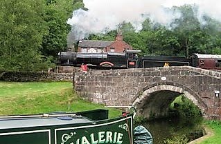
    NB Valerie & Steam Train by Les Biggs

    NB Valerie & Steam Train by Les Biggs