It fully opened in 1790 and followed the 300ft. contour which meant straight was not an option for it`s route.
In the 1820`s it was straightened by about 11/14 miles depending on what articles you read and on the Northern section this was approaching 50% of the original twisting route.


The saving on this section by the new route of A to D eliminating B/C is .75 of a mile. Of course as you travel this new section you`ll notice the canal has been built on an embankment something the original canal builders battled to avoid. Less work but more mileage and slower freight movement.

A is where the old and new join.
B is interesting in that it was the route of the Great Central Railway built in the late 1890`s, 100 years after the canal, from London to Nottingham. It had to span first the River then the canal. The latter is now a footpath so you can walk on and below history. The rail track bed can clearly be seen cutting through the trees.
C is the old canal route crossing the river.
D is the site of the old Clifton Mills station on the Rugby Peterborough line that opened in 1850 with passenger traffic ending in 1953. Also here is the bridge where the canal bed now passes under station road and the site of the old wharf. There is a building here that to me looks very much like an old canal building but being on someones land made a closer view impossible.

You can easily get to this point from the moorings at Rugby Tesco. From bridges 58 or 59 just follow the path on the offside as it hugs the canal. Stay on the path and you will see the above view. Under the arch to the left the canal bed is amongst the trees.
Keep walking and eventually you come to a children's play area, swings etc. Just past this you will see the trees going off to the right.
Don`t look at this high ground and think the canal could not have flown through because this area was a ministry of defense rifle range and my guess is the high ground was artificially created for the range. Follow the tree line and you will come to the river and the view pictured below.
 | ||||||
| Site of the old canal crossing the R. Avon. B on 1880`s map. |
 |
| Another view of the crossing. |
 |
| Bridge in station road the canal flowed under. C on 1800`s map. |
 |
| Old route from Clifton Cruisers. D on 1880`s map. |
 |
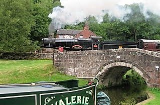
| Approaching Rugby after the long straight past Clifton cruisers. Seeing those two houses the old route came from the right just across from them. |

The old ordnance survey maps come from Warwickshire Archives HERE and there are many tools to use giving measurements and maps of different years.
Just to end this one above shows the area around Barby it saved about half a mile.
Out of interest follow the canal to Braunston and notice some of the old routes still shown. Get to Braunston marina or reservoirs as the 1883-89 map will show. Follow the route of the old canal as it goes across the fields crossing the puddle banks before turning back to the same.
I hope you enjoy as much as I do not just boating in the modern day but taking an interest in the history of our modern day hobby and for some of us where we live.
No comments:
Post a Comment