
For a few days before the trip we were moored opposite the entrance to the arm and below the sign telling us it was just six miles to Aylesbury. On top of those six miles there are also 16 locks but all being well that should be no problem.
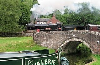
Perhaps the swans and ducks were trying to warn Jaq of what lay ahead of us. The entrance to the first lock chamber of the arm can be seen left of the grey fence. A close up appears lower down the page.


Some readers especially those in the U.S. have little concept of the workings of the UK canal system so I will try to explain the way this staircase lock functions.
Locks one and two are formed by two chambers and three gates. It is the lock in the last post that showed the boat having it`s propeller changed. Jaq is in the second chamber and the middle of the three gates can be seen behind her. In the foreground is the section of canal we need to cruise along. The chamber she has left, pictured left was level with the water on our mooring.
So she entered the first chamber (left pic) and closed the gate. Water was then released into the second lower chamber (where Jaq is pictured above). When this water equalled the water in the second chamber the gates, pictured behind Jaq that are the middle of the three, could be opened. The gates opened and Jaq brought the boat into the second chamber as pictured above. Now this chamber is drained of water and the boat lowers to the level of the canal ahead of us.

In the first diagram the boat has entered the gate into the first chamber. This is the gate pictured above on the left and is also the one in the very first picture.
Water is released from the first chamber into the second chamber by raising paddles on the gates.
In the second diagram you can see the water has levelled between chambers and we can now enter chamber two shutting the gate behind us. Jaq is pictured above in the second chamber.
In the third diagram we open the paddles on the gate in front of Jaq. This lets water flow into the canal below us bringing us to it`s level. When the water is level we can open those gates ahead and move out of the lock and cruise along the lower section of canal. We are now about 12 feet lower than our mooring on the main line of the canal. The next 16 locks will take us down a further 84 feet. The 16 will be standard single locks and not of the staircase type.
Hope this has helped some readers to understand what Jaq and I call home. So now we cruise along the Aylesbury arm.

Signs of some TLC being needed


Keeping the chimney at this angle was just enough to clear the tight arches.


This is the overflow from Wilstone reservoir. CaRT stated 3 days ago the reservoir was overflowing at a rate of 475 litres per second. That's about 100 gallons.....per second! Link to a you tube video

Water now getting worse over the gates.


Twenty five minutes later and it was obvious the water coming in far exceeded the water going out so mother nature won this round.
Shutting the paddles allowed the lock to fill just with the flow over the top gate. Spent three days moored just outside of the lock.

5 comments:
Listen you two ... take it from another boater married to a dumb s____ who didn't know when to get in out of the rain. I remember once when we were trying in very heavy weather conditions to make way in our SV on the west side of Vancouver Island I looked at Charley and asked..."Why in the H___are we doing this?" and he reluctantly turned tail and ran back to the quiet anchorage we left just three hours before. You two won't get extra points for suffering you know.
Use that time to work on your book Jaq....
Pullman Karen now in Benson, AZ
Interesting watershed at Marsworth -
the water you used flows down and eventually reaches the sea via the river Thames, going through London.
Close the paddle on the top lock and continue up the GU canal North and then water will eventually flow into the sea via the river Ouse via Bedford.....
There is a small spring by 'the Ship' cottage in Marsworth which they reckon is the source of the River THAME (not Thames)
Mike Griffin (Cowroast)
Hi Karen
Hope you and Charlie are ok and enjoying snowbirding.
Hi Mike
funny the way water from wherever ends up in the same place. The Ship was also a shop I read somewhere.
as well as a pub.
Post a Comment