"Any sufficiently advanced technology is indistinguishable from magic." ~Arthur C. Clarke
Most of the boaters we know use Nicholson's Guides to navigate along the 2000 miles of British waterways. To date there are seven Guides--one for each canal/river section: Grand Union, Oxford & the South East, Birmingham & the Heart of England, Four Counties & the Welsh Canals, North West & the Pennines, Nottingham, York & the North East, River Thames & the Southern Waterways, Severn, Avon & Birmingham. These Guides are printed spiral bound books with forty years of experience behind them, based on Ordinance Survey (OS) maps. Stanfords, a map sales web site, offers this description:
Ordnance Survey’s mapping from their Landranger series has an overprint highlighting the waterways and adding locks with their names, number and rise, also staircase locks, weirs, turning points, various facilities such as overnight moorings, water points, sewage and refuse disposal, food shops, public houses and restaurants, etc. Towpaths, which can also be used by hikers or cyclists, are clearly marked.
The guides provide descriptions of towns and villages, contact details and where appropriate opening hours of local services, etc. Each guide also includes an introductory section with general advice, regulations and tips.
 First printed in the 1970's the Guide sold for all of 75p. Les bought his set back 2005 when he first made plans to live on a boat. Our guides are tea stained, dog eared, and full of notes about which spots are our favorite moorings, which direction to find a satellite at specific mooring places, which direction the TV antenna should be pointed, and nowadays which sites offer the best 4G wi-fi signal.
The problem with our Guides is that they were actually printed in a date range from 2002-2006 making the data inside woefully out of date. These days the cost of a single Guide is far dearer--£16.99, and we've recently been informed that several of the newer "updates" didn't actually change any of the information inside; the only thing updated was the pictures on the covers which resulted in a fair few boaters returning their new Nicholson's Guides and asking for a refund.
Enter one of our favorite boaters, Paul Balmer of NB Waterway Routes. Paul has been traveling and mapping the British waterways for about a decade now. He also uses OS maps as a base for his canal maps, however any comparison to a Nicholson's Guide should stop here. Paul's maps are far more detailed in terms of where services are located and what ones are available. His maps are easy to read, and also include all the old, disused, buried canals in a given section so if you are a canal history buff like Les, using Paul's maps saves one from slogging around on foot looking for buried signs of old canal routes. This is not to say that searching out the old canal beds isn't a fun bit of walk-about but one need not reinvent the wheel--or old canal route--based on arcane clues. Finally, and most important, Paul's maps are all electronic!
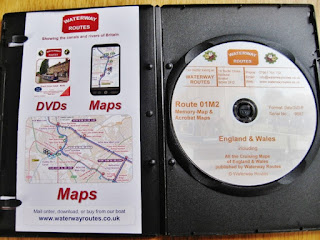
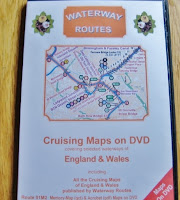 The entire set may be purchased on a DVD for £79.00. Once purchased, monthly updates are available for free from his web site Waterways Routes.
We've had our set for just over a year and I must confess that after loading them on our computer along with Memory-Maps software to read them, we seldom used them when actually cruising. We always fell back on our printed Nicholson's Guides.
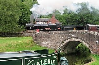
Well all that has changed, thanks to a recent visit from Paul while NB Valerie was moored up in Cambrian Wharf, Birmingham. Les was in hospital, and Paul was kind enough to pay me a visit. As we talked, Paul showed me how he uses the maps on his tablet and phone. A light bulb went off in my head.
Les will not load any apps on his phone as they suck up so much battery usage continually updating themselves; this competes with the massive amount of battery hours my Best Beloved puts in surfing Canal World Discussion Forum on his phone! But I figured I could walk down to the Birmingham Market to a cell phone stall and for £20.00 I could pick up a used Android smart phone on which I could load Paul's maps. Les would be chuffed to bits with it! Using an old phone dedicated to the maps would allow us to keep it out on the stern when we traveled and not worry about interrupting our trip data with phone calls, text messages, and incoming email alerts. Brilliant!!
Paul talked me through the instructions step-by-step and I wrote them down. Les came home before I could get started so we made this a joint project. Rooting around in a drawer where our old cell phones are stored, he found a three year old Samsung. Here is what we did:
1. Use your phone or if you would rather have one device dedicated to maps like we do, then revive an old mobile phone.
2. If you are doing the latter, it needs to have GPS enabled, and an minimum 8GB memory card. It will also need a SIM card. Any one will do. We had a few of those tucked away from previous phones. One of those pay-as-you go SIMS works fine. Once you've put the SIM card in, updated the memory card to 8GB, and charged the device it is time to turn on the wi-fi and go online with it.
3. The device will ask you to register your Google account which is easy enough to do. If you use Blogger then it is your log-in and password for the blog which is also your log-in and password for your Google account. Register your Google account on the device.
4. From the icons choose Google Play. On the Google Play site, type in Memory Maps on the search bar. Download the app to your phone. This app comes with sample maps so open them up and play around a bit. We found one of Birmingham and PING! Suddenly a round icon appeared on the map to mark our location. The GPS was working!
5. Connect the phone to your computer.
6. Place the Waterways Routes map DVD in your computer's DVD player.
7. Go to your computer task bar and click on the Windows icon. From the pop-up menu choose Computer and click on it. (Sorry Mac users--I have no idea what steps you take. Perhaps Tom on NB Waiouru can weigh in with some instructions. Not only is he a Mac user, he's been using Balmer's maps for quite some time. I can hear Tom and Jan clapping and welcoming us to the 21st century!!)
8. Your hard drive, and any other drives and devices will appear listed on your screen--both in the middle and over on the left side menu. Click on the DVD player in the middle of the screen and it will open a list of the items on the DVD--in this case each of the waterway maps will appear listed.


 9. Click and drag each Memory Map Icon waterway map over to the phone or device icon in the left menu. They should go to the CARD not the PHONE. You want to store all these maps on the memory card--not on the actual device memory which will not be large enough to hold them all. The file used for their storage on the CARD is titled DCIM. Park a copy of each map in this file.
Viola!! It is finished! Now you can begin. Find the Memory Maps app icon on your device and open it. Choose the map of the waterway you wish to view. In some cases you may have to access the list of maps by clicking on the My Files icon on the memory card--not the device. If you are on your boat with this device then a round gray icon will appear exactly where your GPS chip has located you.
Below is the legend of Paul's Waterways Routes maps and the maps allow you to add your own colored flags along the canals to mark the things you find important, like good 4G signals, good satellite reception, and favorite mooring spots! I would like to thank Paul Balmer for allowing me to use snips of his material to illustrate this blog. All graphics and data related to Waterways Routes is copyrighted.

One final note: Boaters and walkers update Paul about any changes they find along the waterways that may not appear on his most recent map versions. Paul hops a train and investigates the next day to check out the siting and then updates his maps immediately. In comparison, Nicholson's Guides become an historical artifact soon after purchase rather than a relevant means of navigation. Waterways Routes electronic maps are my kind of magic!
Ordnance Survey’s mapping from their Landranger series has an overprint highlighting the waterways and adding locks with their names, number and rise, also staircase locks, weirs, turning points, various facilities such as overnight moorings, water points, sewage and refuse disposal, food shops, public houses and restaurants, etc. Towpaths, which can also be used by hikers or cyclists, are clearly marked.
The guides provide descriptions of towns and villages, contact details and where appropriate opening hours of local services, etc. Each guide also includes an introductory section with general advice, regulations and tips.

The problem with our Guides is that they were actually printed in a date range from 2002-2006 making the data inside woefully out of date. These days the cost of a single Guide is far dearer--£16.99, and we've recently been informed that several of the newer "updates" didn't actually change any of the information inside; the only thing updated was the pictures on the covers which resulted in a fair few boaters returning their new Nicholson's Guides and asking for a refund.
 |
| Seven Nicholson's Guides plus a Fens Waterway Guide--all out of date, expensive to replace, dog eared, and taking up precious shelf space on our narrow boat. |

 The entire set may be purchased on a DVD for £79.00. Once purchased, monthly updates are available for free from his web site Waterways Routes.
We've had our set for just over a year and I must confess that after loading them on our computer along with Memory-Maps software to read them, we seldom used them when actually cruising. We always fell back on our printed Nicholson's Guides.
Well all that has changed, thanks to a recent visit from Paul while NB Valerie was moored up in Cambrian Wharf, Birmingham. Les was in hospital, and Paul was kind enough to pay me a visit. As we talked, Paul showed me how he uses the maps on his tablet and phone. A light bulb went off in my head.
Les will not load any apps on his phone as they suck up so much battery usage continually updating themselves; this competes with the massive amount of battery hours my Best Beloved puts in surfing Canal World Discussion Forum on his phone! But I figured I could walk down to the Birmingham Market to a cell phone stall and for £20.00 I could pick up a used Android smart phone on which I could load Paul's maps. Les would be chuffed to bits with it! Using an old phone dedicated to the maps would allow us to keep it out on the stern when we traveled and not worry about interrupting our trip data with phone calls, text messages, and incoming email alerts. Brilliant!!
Paul talked me through the instructions step-by-step and I wrote them down. Les came home before I could get started so we made this a joint project. Rooting around in a drawer where our old cell phones are stored, he found a three year old Samsung. Here is what we did:
1. Use your phone or if you would rather have one device dedicated to maps like we do, then revive an old mobile phone.
2. If you are doing the latter, it needs to have GPS enabled, and an minimum 8GB memory card. It will also need a SIM card. Any one will do. We had a few of those tucked away from previous phones. One of those pay-as-you go SIMS works fine. Once you've put the SIM card in, updated the memory card to 8GB, and charged the device it is time to turn on the wi-fi and go online with it.
3. The device will ask you to register your Google account which is easy enough to do. If you use Blogger then it is your log-in and password for the blog which is also your log-in and password for your Google account. Register your Google account on the device.
4. From the icons choose Google Play. On the Google Play site, type in Memory Maps on the search bar. Download the app to your phone. This app comes with sample maps so open them up and play around a bit. We found one of Birmingham and PING! Suddenly a round icon appeared on the map to mark our location. The GPS was working!
5. Connect the phone to your computer.
6. Place the Waterways Routes map DVD in your computer's DVD player.
7. Go to your computer task bar and click on the Windows icon. From the pop-up menu choose Computer and click on it. (Sorry Mac users--I have no idea what steps you take. Perhaps Tom on NB Waiouru can weigh in with some instructions. Not only is he a Mac user, he's been using Balmer's maps for quite some time. I can hear Tom and Jan clapping and welcoming us to the 21st century!!)
8. Your hard drive, and any other drives and devices will appear listed on your screen--both in the middle and over on the left side menu. Click on the DVD player in the middle of the screen and it will open a list of the items on the DVD--in this case each of the waterway maps will appear listed.


Viola!! It is finished! Now you can begin. Find the Memory Maps app icon on your device and open it. Choose the map of the waterway you wish to view. In some cases you may have to access the list of maps by clicking on the My Files icon on the memory card--not the device. If you are on your boat with this device then a round gray icon will appear exactly where your GPS chip has located you.
 |
| The gray icon is NB Valerie moored up at Cambrian Wharf, Birmingham. |
 |
| If you gently but firmly make a slow tap at the top of the device screen showing the map, a tab will appear. Pull it down with your finger. This is where you can track all the data for your trip. See those gray dotted lines to the right of green M24h flag? Those are old, buried canal basins! All the old, buried or disused canal routes and basins appear on Paul's maps in gray dotted lines. This is a fabulous feature because if you are cruising past an old bit of buried canal bed such as one of the old Oxford canal loops, your GPS locater will show you exactly when you are adjacent to the buried section. No, you don't have to be on a boat to use this. It works just fine hand held while walking the canals! |
 |
| All you need to do is tap "Start Logging" and the device will begin logging your trip data! You can re-arrange the data modules on the tabbed screen with the arrow icon. |
 |
| Once you start moving your boat, the gray icon turns red and it moves on the map in real time along with you! As you travel along it will draw a thin red line behind it, marking your route.If you turn off your device or accidentally hit "Stop Logging," the device draws a red line directly from where you were when it was last logging and where you are now; otherwise it uses GPS to draw a direct route which follows your boat exactly. We set our tabbed logging info as shown above while we are cruising so we don't accidentally turn of logging--which I did several times. This also allows us to see the map and just the few bits of logging data in which we are interested. |

One final note: Boaters and walkers update Paul about any changes they find along the waterways that may not appear on his most recent map versions. Paul hops a train and investigates the next day to check out the siting and then updates his maps immediately. In comparison, Nicholson's Guides become an historical artifact soon after purchase rather than a relevant means of navigation. Waterways Routes electronic maps are my kind of magic!