How to Leave a Comment on Our Blog

HOW TO LEAVE A COMMENT ON THIS BLOG
1. Scroll to the end of the post.
2. Click on the phrase "0 comments" or, if there are comments it will indicate how many, for example, "8 comments." Clicking on this will open the comment option for you.
3. Type in your note.
4. Choose your Profile. If you don't understand the choices under Profile then choose Anonymous but PLEASE type your name and location at the bottom of your comment so I know who you are!
Showing posts with label Oxford canal old route. Show all posts

Sunday, May 08, 2016

Canals and Collieries Sowe Common

These bridges cast at the Horsley Iron Works are quite a common site on the canals but this one now gracefully spans the River Sherbourne in Spon End Coventry.
Saying "now spans" indicates a past life and indeed previous to the 1980`s this bridge had spanned the Oxford canal for 150 years.
Below the bridge is pictured in 1955 at it`s original location. The picture was taken from the present day bridge 9 on the Nth. Oxford canal at Sowe common.
 Before the Canal was straightened in the 1830`s beneath the bridge was the original route. The present day route is to the right. Just under the bridge on the left boats were loaded with coal from Craven colliery that arrived by a horse tramway.


The same view I took recently from bridge 9. Now the M6 runs behind the trees but traces of the original route can still be found.

Below is a modern day map laid over an 1888 map. This link will take you to the page. When you get there scroll down and to the bottom left you will see a slider to adjust transparency. Have fun.

This map is dated 1886 and it`s hard to show clearly the area but with modern technology I can give you a link that enables you to see the whole area and zoom in, HERE.  Before you try the link let me guide you a little.

A is bridge 9. Below A is the Jolly Colliers pub just recently demolished to make way for flats. When you zoom in on the map link you will see the horse tramway that brought coal from Craven colliery by way of Woodway Lane. Outside the pub the tramway left the lane and served a large wharf adjacent to bridge 9 where the boats were loaded with Craven coal. The pub had stabling at the rear for boat horses. On the link map Craven Colliery is south of D on the above map. Craven became worked out by 1927 and the miners moved to Coventry colliery that closed in 1991.

B is where the pre 1830`s contour route exited the common next to the present day Wyken coal pit arm. 

C is The Boat Inn on Shilton Lane still doing business today. Immediately to the left of C a canal arm left the main line and turned south to Alexandra Colliery.
The 1850`s landlord of the Boat Inn on Shilton Lane was George Eburn and the bridge nearby was referred to as Eburns bridge. George sold pork, eggs and milk to the canal boaters. 
In 1896 Jacob Nelson took over and he reared cattle, sheep, pigs and horses. The Boat had always held the canal fishing rights and a day ticket gave you the right to fish for the day with a pint of ale with bread and cheese for lunch all for sixpence (6d.), older readers like yours truly will remember it called a tanner, about 2.5p in today`s decimal currency.


A lot of confusion occurs when this area is talked or read about. The above map is  1829 and part of a set that showed all the proposed straightening of the Oxford canal. On the map, below left, the Red line is the section shown bottom right on the map above. The original Wykin Old colliery is marked as "old shaft" on the 1888 map below left. 

The 1829 map above shows the original Wykin Colliery that closed leading to the opening of the Wyken colliery at the end of the present day arm. Note the different spellings of Wyken. I think this is just a map makers mistake. The miners referred to the Wyken arm colliery as "main" and the Alexandra colliery as Wyken. It just means you sometimes read something that makes no sense. Finding the old map does help  with the locations of the two Wyken collieries but you do have to be careful what you read as Wyken colliery might refer to Alexandra.  
As far as I can tell and there is a lot of conflicting information Wyken arm colliery closed in 1881 but bricks were manufactured in later years along the arm.
Alexandra colliery closed in 1919 and Craven in 1927.

Also note the dotted line from Wykin heading for Bedworth. This was proposed as part of the straightening but abandoned when different tolls were agreed between the Oxford and Coventry canal companies for transit through Hawkesbury junction. 

As I have mentioned Hawkesbury junction look at the map above of the proposed canal straightening. Notice how the Oxford is shown running parallel to the Coventry on the left of the map. It did this for about a mile as far as Longford Bridge (10). It opened here in 1777 and was moved to the present Hawkesbury site in 1803.


 Above a 1959 view. To the right behind the Blue dredger is the present day Wyken arm bridge. To the left is the bridge over the original route of the Oxford, B on above map.
The same view today.
This is the site of Eburns bridge a brick hump back taking Shilton lane over the canal. The canal flowed beneath my feet and into the trees across the road. C on the map, the Boat Inn is just a few yards to the right.
Standing in the canal bed looking towards the location of the bridge on Shilton lane.
This is the place the canal after leaving the  main loop crossed back across Deedmore road beneath another brick bridge. Behind me Dutton road industrial site. I am looking towards Alexandra Colliery which is south of point D on the map. From here to the site of the colliery, about three quarters of a mile, is open space as the area of the colliery was used as a domestic rubbish tip by the council in the 1950/60`s. and has been left as open space.
The Shilton lane bridge was just about 100 yards to the left.
Deedmore road bridge

The Boat Inn. From here to the left you can walk and within two minutes find the two bridge crossings and stand in the old canal bed.
Here is a link to the set of about 19 old maps referring to the 1830`s Oxford canal straightening. Mostly the watery Red colour is the proposed straightening.

Link to Boat Inn.

Link to Jolly Colliers.

Wednesday, August 19, 2015

North Oxford canal as built at Clifton Dunsmore

The original route of the Oxford canal between Braunston and Hawkebury Junction has always fascinated me. 
It fully opened in 1790 and followed the 300ft. contour which meant straight was not an option for it`s route. 
In the 1820`s it was straightened by about 11/14 miles depending on what articles you read and on the Northern section this was approaching 50% of the original twisting route.
 Now the section I`m featuring here is at Clifton Dunsmore approaching Rugby and is a perfect example of distance saved by the canal being straightened. On the map above, dated 1883-89, the original route turned across fields at what is now Clifton Cruisers (D). It meandered past Clifton Old wharf(C) that served Clifton Dunsmore village. After the canal was straightened the wharf was relocated to what is now Clifton Cruisers, still serving the village. The old route then turned left after the corn mill to cross the R. Avon (B). 
The saving on this section by the new route of A to D eliminating B/C is .75 of a mile. Of course as you travel this new section you`ll notice the canal has been built on an embankment something the original canal builders battled to avoid. Less work but more mileage and slower freight movement.

This is a Google eye view that I have marked to help locate the following pictures. The old route I have marked Red. The present route enters from the lower left corner crossing the Avon on an aqueduct. 
A is where the old and new join. 
B is interesting in that it was the route of the Great Central Railway built in the late 1890`s, 100 years after the canal, from London to Nottingham. It had to span first the River then the canal. The latter is now a footpath so you can walk on and below history. The rail track bed can clearly be seen cutting through the trees.
C is the old canal route crossing the river. 
D is the site of the old Clifton Mills station on the Rugby Peterborough line that opened in 1850 with passenger traffic ending in 1953.  Also here is the bridge where the canal bed now passes under station road and the site of the old wharf. There is a building here that to me looks very much like an old canal building but being on someones land made a closer view impossible.

 This is the old canal bed that was bridged by the Great Central railway, A on the Google map. 
You can easily get to this point from the moorings at Rugby Tesco. From bridges 58 or 59 just follow the path on the offside as it hugs the canal. Stay on the path and you will see the above view. Under the arch to the left the canal bed is amongst the trees.
 Keep walking and eventually you come to a children's play area, swings etc. Just past this you will see the trees going off to the right. 
Don`t look at this high ground and think the canal could not have flown through because this area was a ministry of defense rifle range and my guess is the high ground was artificially created for the range. Follow the tree line and you will come to the river and the view pictured below.
Site of the old canal crossing the R. Avon. B on 1880`s map.      
Another view of the crossing.
Bridge in station road the canal flowed under. C on 1800`s map.
Old route from Clifton Cruisers. D on 1880`s map.
Approaching Rugby after the long straight past Clifton cruisers. Seeing those two houses the old route came from the right just across from them.

 The old ordnance survey maps come from Warwickshire Archives HERE and there are many tools to use giving measurements and maps of different years.
Just to end this one above shows the area around Barby it saved about half a mile. 

Out of interest follow the canal to Braunston and notice some of the old routes still shown. Get to Braunston marina or reservoirs as the 1883-89 map will show. Follow the route of the old canal as it goes across the fields crossing the puddle banks before turning back to the same.

I hope you enjoy as much as I do not just boating in the modern day but taking an interest in the history of our modern day hobby and for some of us where we live.

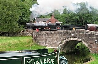
NB Valerie & Steam Train by Les Biggs

NB Valerie & Steam Train by Les Biggs